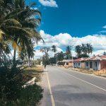
South of the famous Mount Kilimanjaro lies an area of Tanzania that is dominated by other mountain ranges. The South Pare Mountains and Usambara Mountains are both brilliant spots if you want to plan hiking excursions whilst visiting Tanzania, with their own unique histories and cultures that are also well-worth learning about.
The Amani Nature Reserve is also found in this part of Tanzania, known for being one of the largest botanical gardens on the entire continent. If you’re looking for an adventure in Tanzania that is filled with jaw-dropping scenery and incredible biodiversity, this travel guide is perfect for you.
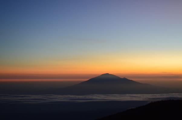
Usambara Mountains
There is only one tarmac road into the Usambara Mountains, and this is the one that wends from Mombo to the small waterfall-focused town of Soni and along a wonderfully lush and picturesque river valley to Lushoto, the centre of regional administration. This extraordinary region is tucked high in the hills, with a surprising local and colonial history.
The region has an aura of sublime natural beauty, with deep valleys and rushing mountain streams at the foot of steep terraced hillsides that rise up to meet the misty morning. In their dense thicket, an abundance of plant species has earned this often overlooked hidden corner of Tanzania a name as ‘the Galapagos of the plant world’.
The Usambara Range is divided into East and West by the 4km wide Lwengera Valley, which lies in between.
All of the mountains in this eastern arc are ancient, far exceeding the age of Kilimanjaro and Meru, and are thought to have formed as mountains around 25 million years ago, although the rock itself was up to 600,000 years old. When this rock was forced upwards it formed an island of plant life that has since enjoyed a haven of climatic stability, rescuing such species from the intensive heat of the plains.
But while the indigenous African Violet thrived in its quiet, natural state, subsequent populations of man in these mountains suffered and endured a far less stable existence.
History of the Usambaras
There is evidence of early iron-working Neolithic settlements in these mountains between 3,000 and 3,500 years ago, and then an influx of Bantu peoples around 2,000 years ago who are thought to have migrated from the Congo. Some of these intermingled with the original tribes, and thus originated the Shambaa, or Sambaa, people of the Usambaras today.
The Shambaa clans traditionally welcomed refugees to their mountainous realm and supposedly lived harmoniously with their neighbours, although little is known historically until the early 18th century and the arrival of the first king of the Usambaras, Mbega, father of the Kilindi Dynasty. Family members of this ruling class are remembered with reverence and awe, with rumours abounding as to how their magical powers were strong enough to make rain and their pale coloured eyes and distinctive pale skin colouration.
King Mbega was also reputedly a professional bushpig hunter from the Nguru Mountains, who took a wife from each clan and provided each with a son to rule it. But when the infamous Maasai tribe assembled on the westward plains and began to threaten the Shambaa livelihood in a determined and warlike quest for grazing land and cattle, the mountain tribe developed more significant political and military structures under the leadership of Mbegha’s grandson, Kinyashi.
From the middle of the 1800s, the Usambaras dealt with violent struggles as they were subject to attacks from their neighbouring tribes plundering livestock and food. They were also attacked by slave traders, but thanks to their elevated position and respected cultural hierarchy, the kingdom survived.
On Kinyashi’s death, his son Kimweri (of the Kilindi dynasty) was proclaimed ‘Simba Mwene’, the Lion King, and he became a powerful military leader, eventually controlling much of the Southern Pare Mountains from his base at Vuga, near Soni. But as the local clan chiefs, Kimweri’s sons, became more adept at raiding the slave caravans for arms to retaliate invasions, they then began infighting for greater power, decentralising and weakening the dynasty.
Vugu was just retained as the Shambaa capital, and the background of military organisation enabled the Shambaa tribes to support the 1888/9 Abushiri Uprising. However, the weakening power base allowed the German Administration to walk in at the latter end, having quashed the rebellion.
Arriving at a time of chaos and disarray enabled the Europeans to persuade individual chiefs to sign away their territories for a small reward. The cool, pleasant climate of the Usambaras attracted a number of settlers to its wide green valleys and so charmed the German administration that they originally wanted to make it their colonial capital, and called the town Wilhelmstal after Kaiser Wilhelm.
The land is wild and steep, but the newcomers implemented building and engineering that still reflect their governmental attitudes. They constructed a solid cobblestone road to climb the 33km between Mombo and Lushoto, which remains mainly unchanged to this day (although resurfaced), and it is still possible to see their original brickwork in the many mountain stream bridges along the way.
This rises on a gentle incline, to allow their oxcarts to pass back and forth with heavy loads, and is shaded by an imposing avenue of wide-trunk plane trees. Settler farming flourished, encouraging a number of stone homes designed in the colonial style, still much in evidence today, and the area was cultivated, albeit with some shaky starts.
The Germans set out with grand plans to develop coffee plantations here, but having cleared the forest and planted crops, it became evident that the new plots did not provide enough shelter. Fruit trees, however, flourished, especially pears and plums, and the area continues to export fresh produce around the country.
Success was also found in plantations of sisal, which made certain planters wealthy men with the freedom to set up country retreats in areas such as Lushoto, where crops also extended to rubber, cotton, tobacco, sugar, wheat and maize.
After the Versailles Treaty of 1919, Tanganyika was made a Mandate Territory under the League of Nations and then awarded to Great Britain for administration. Although the British discouraged settlers, there were many civil servants who did need to build their own houses. Many of these good-looking buildings can still be found around the Lushoto area, adding to the bizarre combination of old colonial German and British alongside African homesteads, all situated in a distinct natural and yet well-cultivated landscape.
Where to Go in the Usambara Mountains
The excellent tourism office in Lushoto town (signposted left past the bank) is extremely helpful in organising guides for visitors interested in driving, walking or hiking around the area. They provide numerous options for camping, overnight stays with local families or days out, and guides are likely to charge a fee per person per day on top of the $10 charge paid to the Tourism Project.
Irente Viewpoint
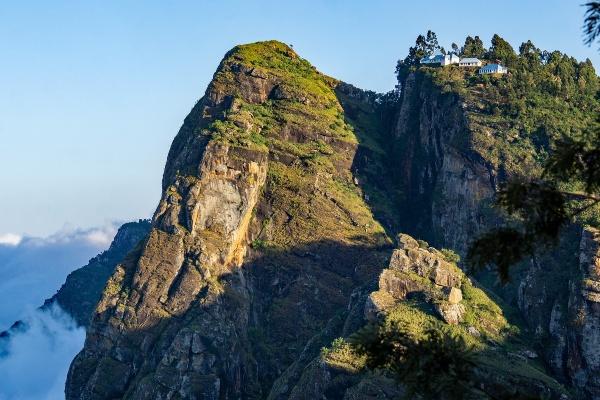
One of the easiest and most impressive natural areas to reach on an enjoyable walk from the town centre is Irente Viewpoint. This is a wild rocky outcrop, approached along a narrow, flower-fringed walkway and emerging at a giddy windblown height above the Maasai steppe.
The round trip takes between three and four hours on foot from the town, although anyone with private vehicles is able to drive a large portion of the way if desired. The views are superb and the nearby scenery is impressively dramatic.
An old campsite cunningly named both Viewpoint and Bellavista Campsite has been renovated and improved by Louis, the charismatic proprietor, who obviously has exciting plans for his campsite and his cooking, although so far guacamole is the only recommendation. Prices presently seem to reflect future aspirations and are no doubt negotiable at Tsh 5000 rent, Tsh 2000 park.
Any guide from the tourism office can show you the way to Irente Viewpoint, but the route is clear from Irente Farm. The farm has developed as a worthwhile stopover for buying picnic goods since it has established itself as a reliable producer of wholemeal bread, jams and fresh dairy products, and any traveller to Tanzania for any length of time will appreciate the joy of a delicious cheese supplier!
The farm has also received attention from the legendary local homemaker, known as Comrade ‘Kipepe’, meaning ‘butterfly’, who has sculpted his family home entirely from mud, including the table, benches, shelves and water system. Kipepe has now built a mud shop, ‘duka’ in Swahili, at Irente, artistically headed with a wide head of a horned cow.
Catholic Mission of the Montessori Sisters
More homemade goods can be found in production at the landscaped and lovingly tended Catholic Mission of the Montessori Sisters in Ubiri, where wines, cheeses and jams can also be inspected, tasted and bought. The mission can be visited on a three to four-hour walking round trip from town.
Vuli
A slightly longer walking trip of between four and five hours leads up to the farmlands of Jaegertal, through an impressive fruit tree nursery and on up to the village of Vuli, which has benefited from irrigation, conservation and farming projects. This walk can also include a return trip via the Lushoto Arboretum or Herbarium; an impressive collection of pressed plants and leaves collected from around Tanzania during the German era. To see the collection independently, ask for Mr Msangi or Mr Mabula.
Magamba Rainforest
Guides can also lead a rewarding walk to the Magamba Rainforest, inhabited by troops of dashingly collared colobus monkeys and numerous species of forest bird, including the Usambara akalat and Usambara weaver, making this a particularly rewarding destination for anyone with special interests in birdwatching. It is possible to camp on the quiet site near a disused sawmill at the centre of the forest, equipped with a loo and running water, or to make your way to the comfortable and welcoming lodges at Mkuzi and Migambo, mentioned below.
The walk to Mgamba from town also goes via the royal mountaintop village of Kwembago; the ancient centre of the Daffa family, a subclan of the traditionally revered ruling class the Kilindi Dynasty. This trip takes between five and six hours on foot, and returns through the village of Magamba, from where it is also possible to catch a bus back to Lushoto or on to Mlalo.
Mtae
Longer trips can be made over a period of days, either camping or staying in guesthouses en route. An excellent longer trek leads through the forests, mountains and valleys and villages between Lushoto and the quaint and historic village of Mtae; an important elevated boundary post between the Maasai plains and lands of the Shambaa high on the westernmost rim of the West Usambara escarpment.
The first German European missionaries were allowed to build their church in Mtae (sometimes written Mtii), having survived the ordeal of being led to an ancestral burial site by the local chief and bewildering him when they were not destroyed or distracted by the potentially fatal mizumu, the spirits of the dead. The panoramic views from here are worth the climb, with mile upon mile of extraordinary landscape stretching to the far horizon to reveal the Southern Pare mountain ranges and Mkomazi game reserve, Nyumba ya Mungu reservoir and sometimes even the peaks of Kilimanjaro, 250 kilometres in the distance.
The first road down the western face is presently being constructed to Mtae with donations from the ancestors of the first European visitors, so forging a historic link between these mountains and the Maasai plains below. A couple of simple but welcoming guesthouses in Mtae provide rooms for just two or three dollars, the Mwivano II is just slightly more costly than the Kuna Maneno.
A local café near the bus station provides wholesome plates of local food and homemade bread, and a nearby bar sells beer – although not necessarily cold.
Buses between Mtae and Lushoto take around two hours, leaving Lushoto in the mid-afternoon and leaving Mtae at 5.30 am.
Mlalo
New tours have recently been added to the range organised by the Cultural Tourism Program, one of which heads even further into the Usambara range to discover the isolated and idiosyncratic town of Mlalo, clinging high in the hills 30 km from Lushoto. Surrounded by a dramatic backdrop of wild mountain peaks, Mlalo is a rambling sprawl of extraordinary homes designed with two storeys and prettily carved wooden balconies in a neatly cultivated and terraced valley irrigated by the Umba River.
The town produces a number of hand-crafted pots in the tradition of the Shambaa, who once believed that the creator god Sheuta formed people from the earth as a potter works her earthen vessels. Ancient beliefs hold that pot-making is the work of women, with techniques passed down the matrilineal line from mother to daughter. Their pottery and pots made in the nearby village of Kileti are then transported to the Lushoto market for sale.
Buses run daily between Lushoto and Mlalo, via Magamba, and take around two hours. The Afilex Hotel is generally recommended as the best guesthouse, although be prepared for reading by gaslamp, as there is no electricity this far into the mountains.
Amani Nature Reserve
The Amani Nature Reserve is located in the Muheza and Korogwe Districts of southern Tanzania and is a protected area of land focused on promoting biological diversity. It’s home to one of the largest botanical gardens in Africa and was created to try and preserve
History of the Amani Nature Reserve
The German colonial government realised the rich potential of this mountain region for growing crops when they invaded, and although the coffee plantations in this region were not terribly successful, they had far greater rewards from plantations of sisal, tobacco, and spices. Their environmental studies developed the Arboretum at Lushoto, and they soon became aware of the unusual density of wildlife in the Western Usambara Range.
In 1902, thirteen forest reserves were surveyed and gazetted, including 8,380 hectares at the Amani Nature reserve north of Muheza. This incorporates 1.065 hectares now owned by private tea companies managed by the East Usambara Tea Company and the Amani Botanical Garden, one of the largest of its kind in Africa.
A large number of indigenous species were left rooted, and over 1,000 species of exotic trees were imported from foreign climes. Many of these can still be identified by their ancient metal nameplates, still legible if a little dusty. Still, the botanical garden is now extremely overgrown and large areas remain impenetrable.
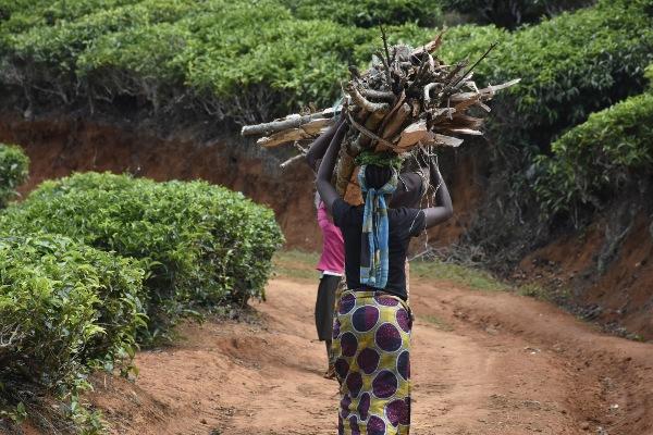
The Research Centre was officially closed during World War II, although it made a contribution to the war effort by devising quinine from the local cinchona tree. When the British finally had time to invest in the area after the war they planted 2,200 hectares of tea plantations in cultivated regions and built a hydroelectric power station, the remnants of which can still be seen.
They reopened the research centre in 1953 with an emphasis on agriculture, and then moved this department to Kenya in 1961, where it finally became a centre for Malaria Research and remains so to this day.
Visiting the Amani Nature Reserve
Walking paths that have been cleared enough to enjoy run from the top of the hill near to the Rest House and Research Centre; a steep climb by all accounts. Even in a tough 4×4 vehicle, you will be inundated by tea plantation workers desperate for a lift.
Despite concerted efforts to regenerate this resource for tourists today, the Botanical Gardens and Forest Reserve still remain sorely underdeveloped in this respect. However, the old German stationmaster’s house nearby, dating from between 1905 and 1910, has been beautifully restored and converted into a fine Information Centre for the reserve.
South Pare Mountains
The rural spread of the Southern Pare mountains is a magical, forested expanse of hidden villages, valleys and homesteads clinging to steep handmade terraces. The tourism project here is located high in the Mbaga Hills, in an area with an extraordinary local and colonial history.
History of the South Pare Mountains
The Pare people are known to have had an extensive fortified capital, under their chief Ghendewa. He was known for having started and managed a conscript army and masterminded a unified tribe with a ‘sophisticated social system’. Ghendewa was killed fighting the Chagga people.
Reverend Jacob Jenson Dannholz, a missionary from Leipzig, came to live in Mbaga for approximately 10 years between 1908 – 1917, and built a church and farmhouse on Tona Moorland. Locally known as The White Man’s House, it is officially named ‘Dannholz Cottage’ in honour of the man who built it. This has been used by the missionaries ever since, and four bedrooms are available for visitors.
Local Culture in the South Pare Mountains
The traditional Pare culture is still much in evidence, and witch doctors from here are so renowned that people travel long distances to decipher unusual problems, even urban dwellers from Arusha. Areas such as Malameni Rock, where children were sacrificed to appease evil spirits until the 1930s, can now be climbed after receiving special instruction from the hut below.
It is not far from here to the legendary Mghimbi Caves, which provided a natural hideaway and haven for local tribes during slave raids. Both of these can be visited on a half-day walk.
More spiritualism can be found among the tropical fruit trees and banana palms in Ikongwe Village, reached on a full-day excursion from Mbaga. The village is a beautiful and fruitful area that is believed to be a gift from the heavens, and now where a very distinct religious community has developed.
Another area considered with great respect by local communities is Mpepera Viewpoint atop Mpepera Hill, where a cross has been erected to represent the peace between the resident Catholic and Protestant communities. The viewpoint is used by locals as a peaceful area for prayers and gives excellent views of Mount Kilimanjaro, or the Mbaga Hills and Mkomazi Game Reserve when the skies are clear.
Full-day walks can also be arranged into local villages to visit families practising traditional methods to brew beer. You can also opt for longer hikes through unspoilt woodland such as Shengena Forest.
Here it is possible to camp under the stars and wake up for a sunrise hike up Shengena Peak, the highest point in the Pare and Usambara Mountains at 2,463m above sea level, and discover fresh springs and troops of colobus monkeys and enjoy magnificent views over Same and Lushoto.
If you want to plan a holiday to any of the areas we’ve talked about in this blog post, Tanzania Odyssey is a specialist tour operator that can help you plan a tailor-made travel itinerary to this brilliant African country. Take a look at our tours of Northern Tanzania or get in touch to find out how we can help with planning your trip.

